| 
  • If you are citizen of an European Union member nation, you may not use this service unless you are at least 16 years old.

  • You already know Dokkio is an AI-powered assistant to organize & manage your digital files & messages. Very soon, Dokkio will support Outlook as well as One Drive. Check it out today!

View
 

Stop 9: Monahans Sandhills State Park

Page history last edited by Matt Farris 12 years, 5 months ago

back to Field Trip Synopsis

back to Stop 1: Playa Lakes near Haskell, TX


Monahans Sandhills is on the egde of the Southern High Plains. This is a topographic trap where the sand is trapped by the caprock feature called "Caliche."


Close-up Caliche in previous picture. The caliche is a carbonate rock which has a lower hydraulic conductivity than the surrounding sand.  


This is eveidence of a perched aquifer. There was a pluvial event in the Pleistocene that caused more running water to occur, but now the sand dunes are eolian.


The caliche underlies the sand dunes.


Scenic view


Rough sandstone (indurated) found at the surface of the sand dunes.


Sand ripples caused by wind erosion.


Field Trip Synopsis
Stop 1: Playa Lake near Haskell, Tx. 


Comments (1)

Jonathan Price said

at 7:44 am on Nov 27, 2011

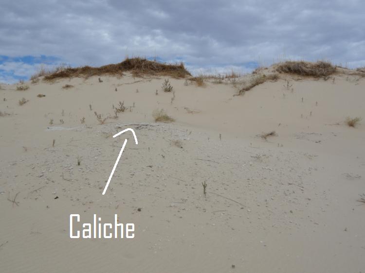
Great job on locating a good-looking caliche bed and the perched aquifer!

You don't have permission to comment on this page.